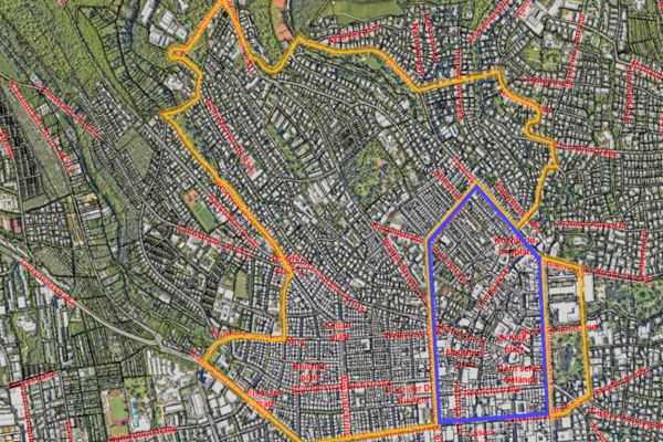
Arsenic contamination area
A scientific study by the Hessian State Office for Soil Research (today: Hessian State Office for Nature Conservation, Environment and Geology HNLUG) has found natural, so-called geogenic deposits of arsenic and thallium in the soil of the "Bergkirchenviertel" in Wiesbaden.
This is due to thermal springs that have since dried up, which caused the accumulation of these substances in the soil for around 10,000 years. The natural distribution area of the two chemical parameters is essentially limited to the core area of Wiesbaden's Bergkirchen district. The concentrations of arsenic and thallium can vary greatly within a small area. Only chemical soil tests can provide concrete information on a case-by-case basis.
As the ingestion of these substances can lead to health risks in the event of direct contact with the soil and may result in increased disposal costs during construction work, attention is drawn to the arsenic problem in construction projects in Wiesbaden's Bergkirchen district.
Contact us
Suspected contaminated sites - obtain information
Address
65189 Wiesbaden
Postal address
65029 Wiesbaden
Arrival
Notes on public transport
Bus stop Statistisches Bundesamt; bus lines 16, 22, 27, 28, 37, 45, X26, x72, 262
Telephone
- +49 611 312295
- +49 611 313957
Information on accessibility
- Barrier-free access is available
- The WC is barrier-free
