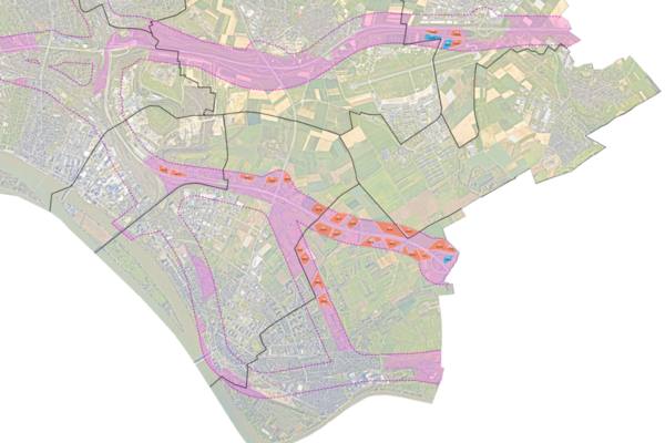
Potential areas for ground-mounted solar systems in Wiesbaden
Solar power systems can now be installed more easily near freeways and railroad lines. The Environment Agency uses a map to show potentially suitable locations.
The expansion of renewable energies is a central pillar of Wiesbaden's urban climate protection goals. The photovoltaic strategy envisages the construction of solar power plants with a peak output of at least 328 megawatts (MWp) by 2045. The majority of these are to be installed in built-up areas on roofs and façades over already sealed surfaces. Achieving the overall target will be made easier by the latest amendment to the German Building Code (Section 35 (1) No. 8 b), as it creates new opportunities for the development of solar installations in outdoor areas. For example, open spaces within a buffer zone of 200 meters from freeways and higher-level railroads can now be used more easily for these systems.
As part of a preliminary assessment, the environmental office of the state capital of Wiesbaden examined the areas within this buffer zone on the basis of environmental and nature conservation criteria. The results of this investigation have been published in a current potential map. It covers around 80 hectares of potential areas and serves as a guide for private investors, municipal utility companies and all interested parties planning the expansion of solar power systems or solar thermal systems on open spaces.
The map provides an assessment of the possible development and approval potential for areas. The designations on the map are not legally binding, but merely provide information on the suitability of a site. A case-by-case assessment remains necessary in all cases.
